The national parks of the Canary Islands are areas of great natural beauty. The archipelago currently has four parks, each on a different island. The Teide National Park on Tenerife, the Garajonay National Park on La Gomera, the Caldera de Taburiente National Park on La Palma and the Timanfaya National Park on Lanzarote. This uniqueness makes the Canary Islands the autonomous community in Spain with the most national parks.
National parks are areas of high natural and cultural value, little transformed by human activity. Due to their exceptional natural values, the uniqueness of their flora and fauna, their geomorphological formations or the representativeness of their ecosystems, these parks deserve to be preserved and cared for as a matter of priority.
For a territory to be declared a national park , it must meet a series of requirements. On the one hand, it must be representative of its natural system and have a large and sufficient surface area to allow for natural evolution and ecological processes. In addition, it must be largely dominated by natural conditions and not present any intervention on its natural values or continuity of its territory. Of course, it must not have inhabited urban centres within it, except in exceptional cases.
In the following, the four national parks of the Canary Islands will be described and differentiated in order to gain a deeper understanding of the characteristics of these exceptional territories.
Teide National Park
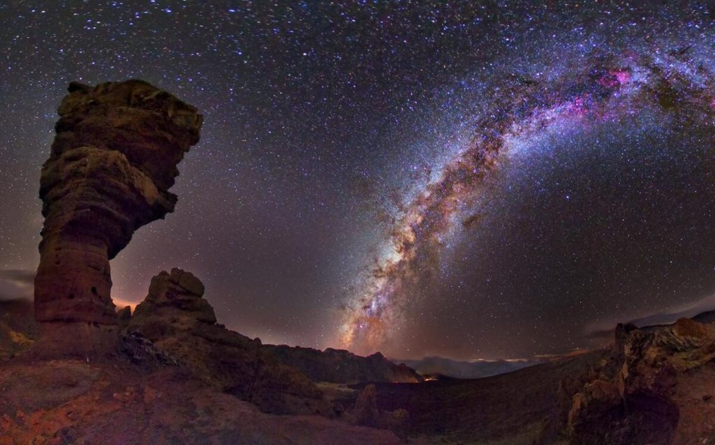
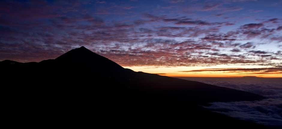
The Teide National Park is located in the centre of the island of Tenerife. It is the largest and oldest of the Canary Islands' national parks, declared as such on 22 January 1954 and a UNESCO World Heritage Site in 2007. It is visited by more than three million tourists every year.
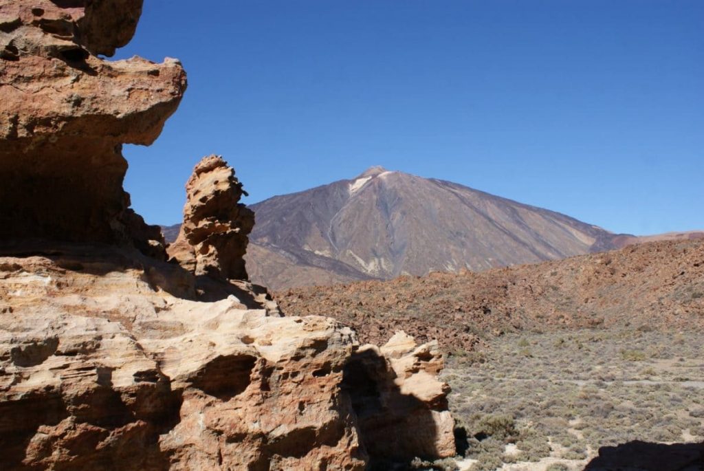
This area is home to the famous Teide volcano, the third largest volcano in the world from its base of origin. Known in the Guanche language as Echeyde, at 3,718 metres it is the highest peak in Spain and on any land that has emerged from the Atlantic Ocean. Next to Teide is Pico Viejo, the second highest volcano in the Canary Islands, at 3 129 metres.
The national park covers an area of almost 19,000 hectares, the largest of the four Canarian parks, and is surrounded by the Corona Forestal Natural Park, which, with 46,612 hectares, is the largest protected natural area in the whole archipelago.
Touring the area, even by car, is quite a spectacle. The park is one of the most impressive geological spectacles in the world, with its collection of lava flows and volcanic cones of different shapes and colours. To get to know it in greater depth, it is advisable to go up one of the access roads and down another, finding a greater contrast if you go up from the north and down from the south, or vice versa. It also has an extraordinary biodiversity made up of 194 species of plants, 58 of which are considered endemic to the Canary Islands, and an endless number of animal species that inhabit the park temporarily or permanently.
Caldera de Taburiente National Park
The Caldera de Taburiente National Park is located in the centre of the island of La Palma. Like the rest of the archipelago, La Palma has volcanic origins, but it is different from the rest of the islands because of the amount of water resources it possesses, both underground and on the surface. The Caldera de Taburiente was declared a national park on 6 October 1954 and, since 2002, the park has been classified as a Biosphere Reserve, together with the whole island.
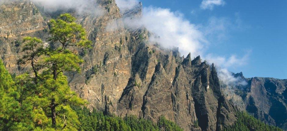
The park covers an area of 59 km2. The great depression formed by the Caldera, one of the largest of its kind in the world, lies between 600 and 900 metres above sea level and is surrounded by a cirque of peaks 8 km in diameter. The highest peaks on the island are found here: Roque de los Muchachos (2 426 m), Pico de la Cruz (2 351 m), Piedra Llana (2 321 m), Pico de la Nieve (2 236 m) and Punta de los Roques (2 085 m).
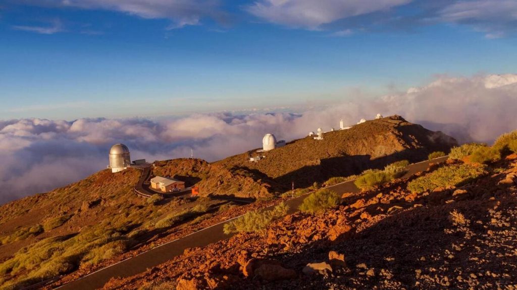
The Roque de los Muchachos is the highest point on the island, making La Palma the second highest island in the Canary Islands. The so-called "beautiful island" has one of the best skies in the world for observing the universe, which is why the Roque de los Muchachos Observatory, belonging to the Canary Islands Astrophysics Institute and inaugurated in 1985, is located on this rock.
The flora and fauna of La Caldera de Taburiente is very rich and full of diversity. In terms of plant species, the Canary Island pine stands out, which is also a plant symbol of the island. As for the fauna, invertebrates predominate, due to the characteristics of the terrain, but also birds.
Timanfaya National Park
The Timanfaya National Park is located in Lanzarote, in the municipalities of Yaiza and Tinajo, in the southwest of the island. It was declared a national park on 9 August 1974 and is the only one in Spain with an eminently geological character, the result of volcanic eruptions that took place between 1720 and 1736, and in 1824.
The park covers an area of 5,000 hectares and has more than twenty-five volcanoes, some of them emblematic, such as the Montañas del Fuego, Montaña Rajada or the Caldera del Corazoncillo. The island is still volcanically active, with hot spots on the surface reaching 100-120 degrees and 600 degrees at a depth of 13 metres. In addition, the park is home to many unique features of scientific, geological and geomorphological interest, such as hornitos, caves, malpaíses, etc.
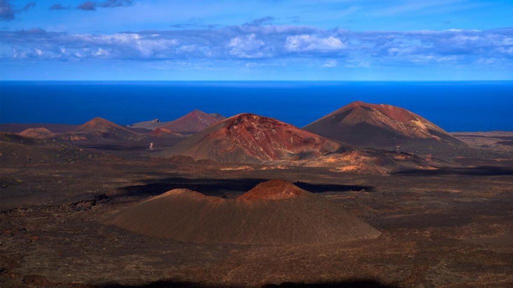
As it is an area where human presence has been almost non-existent, the park is in the early stages of ecological succession, which makes it an excellent place for research into colonisation processes. In total, some 180 plant species can be found in Timanfaya, mostly lichens. As for the fauna, reptiles and birds dominate.
Garajonay National Park
Garajonay National Park is located in the centre of the island of La Gomera. It was declared as such on 25 March 1981. In 1986 it was declared a World Heritage Site by Unesco and, since 2012, it has been listed, along with the whole island, as a Biosphere Reserve.
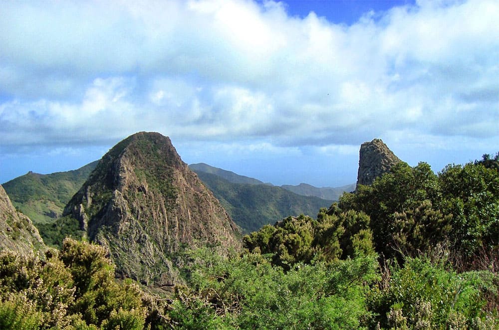
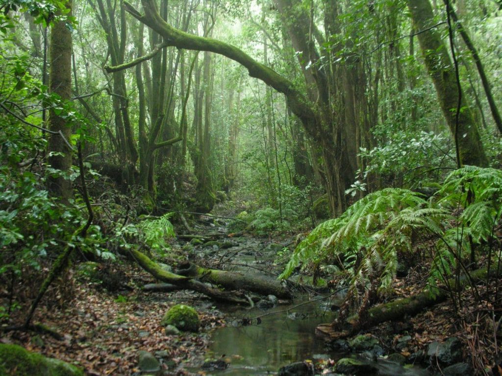
The park takes its name from the peak of Garajonay, a mountain that is the highest point on the island at 1,485 metres above sea level. It covers an area of 3 984 hectares and its territory extends over all the municipalities of La Gomera. The main feature of Garajonay is the dense forest or Monteverde of different plant species that covers it, often enveloped by a sea of clouds. This evergreen forest is called laurisilva, which means laurel forest, and represents a sample of the subtropical landscape of the Tertiary era, more than 20 million years ago, in southern Europe and North Africa.
In addition, the park has a huge network of trails that are very popular with tourists visiting the island. You can consult different hiking routes in the Garajonay National Park in the following article from Marca Canaria.
Other values of the Garajonay National Park are its endemic fauna, less than its flora, but just as important, as well as the existence of spectacular geological monuments, such as the Roques.
For more information and to organise visits and excursions to the different national parks of the Canary Islands, please consult the official website of the Government of the Canary Islands.
Paula Vera
Photos: Government of the Canary Islands, holaislascanarias.com, lagomera.travel